
After a container ship caught fire and sank in the Red Sea, BM was tasked with locating the wreck and determining whether it posed an environmental risk. Given the depth and scale of the incident, a thorough assessment was required to evaluate the potential impact on the surrounding ecosystem and maritime operations.
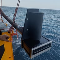
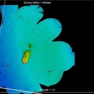
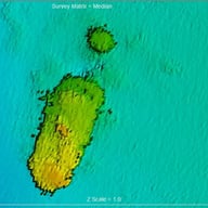
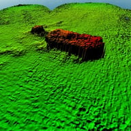
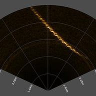
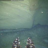
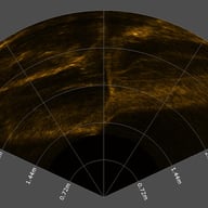
To begin, an MBES (Multi-Beam Echo Sounder) survey was conducted to detect the wreck and analyze its position, orientation, and structural integrity. This initial data was crucial in planning the ROV mission, ensuring an efficient and targeted inspection. The wreck was located at a depth of 300 meters, and due to the possibility of structural instability and pollutant leakage, a detailed visual assessment was deemed necessary.
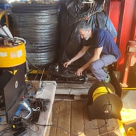
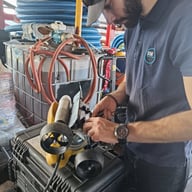
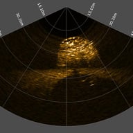
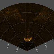
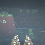
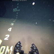
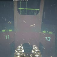
With the precise location confirmed, BM’s highly advanced ROV—equipped with a USBL positioning system and a Dual Frequency Imaging Sonar—was deployed for an in-depth inspection. Despite the challenges of deep-sea operations, the wreck was thoroughly examined to assess any immediate or long-term hazards. UHD videos, high-resolution photographs, positional data and imaging sonar data were collected, providing the client with a comprehensive visual and analytical report. Alongside detailed measurements, this data enabled them to perform a well-informed risk assessment and plan any necessary mitigation efforts.
Interested in how our expertise can benefit your project? Let's discuss how we can support your next challenge!
Address
131 Praxitelous Street, Piraeus 185 32
Contacts
+30 210 411 5697 info@bmconsult.gr
© Copyright 2024 BMConsulting All Rights Reserved