Subsea Oil Terminal Pipelines 3D Integrity Assessment
Project Context
BM was engaged to support an oil terminal operator abroad in the preliminary stage of a structured Fitness-for-Service (FFS) assessment of its offshore subsea pipelines.
The scope focused on exposed pipeline sections requiring geometric baseline establishment and condition documentation prior to analytical evaluation under API 579-1 / ASME FFS-1.
Objective
The campaign aimed to:
Establish a geo-referenced geometric baseline of exposed pipeline sections
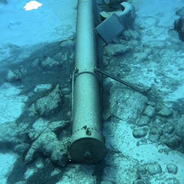
Document surface condition and degradation features
Support FFS component segmentation and thickness measurement planning
Perform an initial free-span screening assessment
This phase formed the foundation of a staged FFS methodology.
Technical Approach
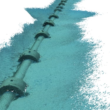
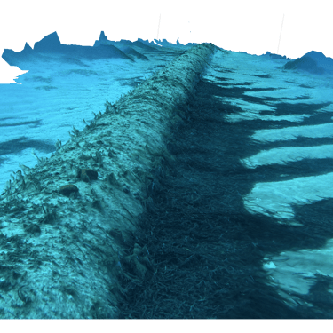
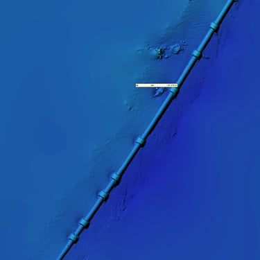
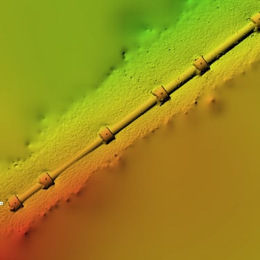
The inspection was performed using an instrumented ROV equipped with ultra-high-resolution imaging, calibrated scaling references and integrated navigation sensors for spatial referencing.
Multi-angle image acquisition enabled structured photogrammetric reconstruction of exposed pipeline segments, including field joints and coating transition zones.
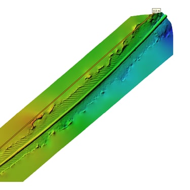
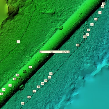
3D Photogrammetric Methodology
A controlled acquisition protocol was applied to generate a geo-referenced, metrology-oriented 3D model of the pipeline geometry.
The reconstruction was tied to the project coordinate system, enabling spatial traceability and repeatable re-inspection.
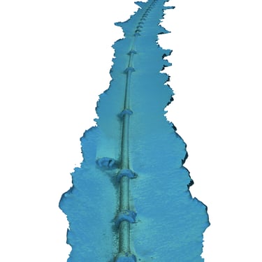
The resulting model supported:
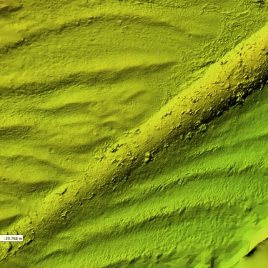
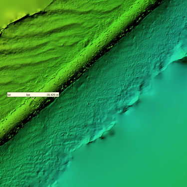
Local deformation verification
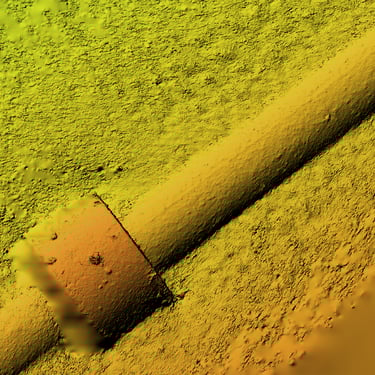
Coating breakdown and corrosion mapping
Spatial anomaly referencing for FFS component definition
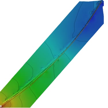
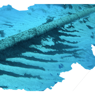
Initial Free-Span Screening Assessment
Using the geo-referenced 3D model and visual data:
Unsupported sections were identified and geo-located
Span lengths and clearances were measured
Seabed interaction conditions were documented
This constituted a geometric screening stage. Detailed hydrodynamic or fatigue verification was planned for the subsequent analytical phases (ongoing project).
Engineering Output
The campaign produced:
Geo-referenced defect mapping (in 3D)
FFS-relevant component segmentation
Identification of candidate locations for targeted thickness measurements
Preliminary free-span dataset
All outputs were structured for direct integration into subsequent FFS and structural assessment.
FFS Integration
The 3D assessment supported Level 1 screening and structured planning for Level 2 analytical evaluation. It optimized the follow-up NDT campaign without replacing formal thickness measurement or structural verification.
Outcome
A traceable, geo-referenced geometric and condition baseline was established, enabling progression toward systematic thickness measurement, corrosion rate formation and formal Fitness-for-Service assessment.
Address
131 Praxitelous Street, Piraeus 185 32
© Copyright 2024 BMConsulting All Rights Reserved